Snake River at Moose WY water levels, snow depth, temperatures, etc.
Department of Commerce (DOC) National Oceanic and Atmospheric Administration (NOAA), Climate Data Online (CDO), The National Centers for Environmental Information (NCEI) provides free access to the, National Center for Environmental Information (NCDC)'s archive of global historical weather and climate data in addition to station history information.
Note: That data come from: https://www.nrcs.usda.gov/wps/portal/nrcs/detail/null/?cid=nrcseprd1314833
Data on the website right now is from:
Discharge, water temp : Source: USGS Water Data
Link: https://waterdata.usgs.gov/nwis/uv?site_no=13013650
Snowfall, snow depth: Source: USGS Water Data
Link: https://waterdata.usgs.gov/nwis/uv?site_no=13013650
Temperatures: Source: NOAA US Climate Data
Link: https://www.usclimatedata.com/climate/jackson/wyoming/united-states/uswy0088


The highest water discharge levels occur each year in June. 2017 and 2018 had the highest levels since 2011.

Water temperatures throughout the years have stayed in similar ranges. This graph shows the information provided for months between March and October. Some years did not show data for March, May, and November.
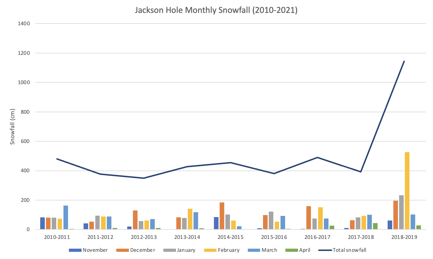
This graph shows the snowfall documented between November and April from 2010-2019. The winter season of 2018-2019 experienced the highest snowfall totals in the past 9 years.

Snow depth is measured seasonally November through April from 2010-2019. The 2018-2019 season had record snow levels.

